It was September of 1971. I was on a bus leaving the Port Authority Station in Manhattan heading into New Jersey. My day had started in St. Louis. I was traveling with a friend from high school who claimed he knew what he was doing. Our destination was the campus of Princeton University.
In those days you didn’t visit multiple campuses before deciding where to go so I had no idea what to expect. Kevin’s plan was to fly into New York and take the train south to Princeton. I seem to remember that in addition to my suitcase, I had a new typewriter and a tennis racket. I don’t recall that I had ever actually played tennis so why I had a racket seems a bit suspect.
We flew to LaGuardia Airport and took a bus into Grand Central Station where we discovered that the trains from Grand Central went north. Southbound trains to New Jersey left from Penn Station. The ticket agent pointed towards a corridor and told us we could simply walk a few blocks underground to change stations. New York City was not a welcoming place to a couple of naive teens from the Midwest. We wandered through tunnels in the heat and humidity. Eventually, we somehow stumbled our way into the Port Authority Bus Station and bought a bus ticket to Princeton (it was several years later before I ever set foot in Penn Station).
The bus to Princeton travels through the Lincoln Tunnel, through the streets of Newark (a city I knew only as a place that had seen riots three years earlier in 1968), past oil refineries, and onto the New Jersey Turnpike. This naive child from the suburbs in the Midwest was on sensory and emotional overload. I was fingering the dime in my pocket and formulating the call to my mom to come rescue me.
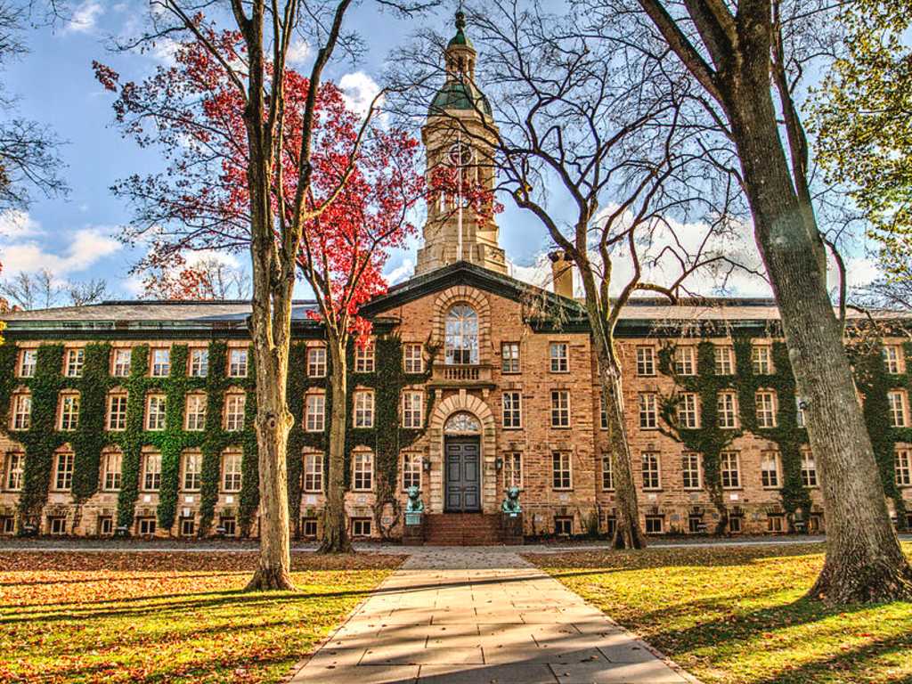
Eventually we left the Turnpike and turned onto Route 206 which winds through the farmland that gives New Jersey its nickname, the Garden State. Route 206 turns into Nassau Street and the bus dropped me at the entrance to the Princeton Campus. The image above is Nassau Hall, my first impression of where I would spend the next four years. The dime stayed in my pocket.
“The map is not the territory†was a dictum offered by Alfred Korzybski, a Polish scientist/philosopher who developed the field of general semantics shortly before WWII. It’s a reminder that expectations and reality rarely coincide and you would be well-served to check how, where, and why they differ.
That day was a series of collisions between expectations and reality complicated by the confounding factor that I didn’t recognize how many unexamined expectations I was carrying in my head. Traveling that territory that day planted another seed in learning how to draw better maps and in recognizing that map-making was a tool I could use deliberately to make sense of the new territories I was trying to travel.